Getty-supported project brings Rio’s dynamic past into the 21st century. Scholars, tourists, and locals eager to learn more about Rio de Janeiro have a new way to dive into its history with imagineRio, a digital platform that makes visible centuries of dramatic change in the city’s built environment.
Supported by a grant from the Getty Foundation, the newly enhanced digital atlas will allow users to view thousands of digitized archival photographs, architectural plans, and landscapes that animate Rio’s evolving cityscape.
Rio’s current geography is far different from its past, as city planners literally moved mountains, remade beaches, demolished neighborhoods, and constructed new buildings where there was once just water. imagineRio reveals hundreds of years of human intervention responsible for the metropolis’s iconic vistas and invites users to explore its history through architectural drawings, painted views of its shifting landscapes, and pioneering Brazilian photography transformed through 3D geolocation.
With imagineRio, urban planners can study Rio’s growth over time, local residents can reconstruct changes in their neighborhoods, art historians can speed up once time-consuming research of historic buildings and sites, and literary scholars can map out novels, among many other uses. This is all made possible through innovative geospatial and digital mapping tools and years of archival research, technical experimentation, and cross-continental collaboration.
imagineRio v3 Demo from Spatial Studies Lab. Animation of Rio’s evolution over time. It shows the demolition of Castelo Hill and subsequent occupation of the area, including the Santos Dumont Airport landfill made with the hill’s debris/rubble. Courtesy imagineRio
imagineRio was funded as part of the Getty Foundation’s Digital Art History initiative, an ongoing effort to utilize the latest digital technologies for art historical research.
“There are tremendous opportunities for art historians to apply tools like digital mapping to reshape our understanding of how cities and their cultural landscapes develop,” said Heather MacDonald, senior program officer at the Getty Foundation. “imagineRio lets users see in a few seconds an urban evolution that took decades to unfold.”
One of imagineRio’s new features is a trove of over 3,000 geolocated photographs of the city from the 19th and 20th centuries, drawn from the extensive photography collections at Brazil’s Instituto Moreira Salles (IMS). Viewers can browse some of Rio’s most recognizable sites over time, including Christ the Redeemer atop Corcovado Mountain, Copacabana Beach, and Sugarloaf Mountain, alongside historical maps, architectural plans, and earlier views of the city that were painted or sketched by artists. Users can create filtered views with categories such as creator, year, and building type to produce customized searches from over two terabytes of data.
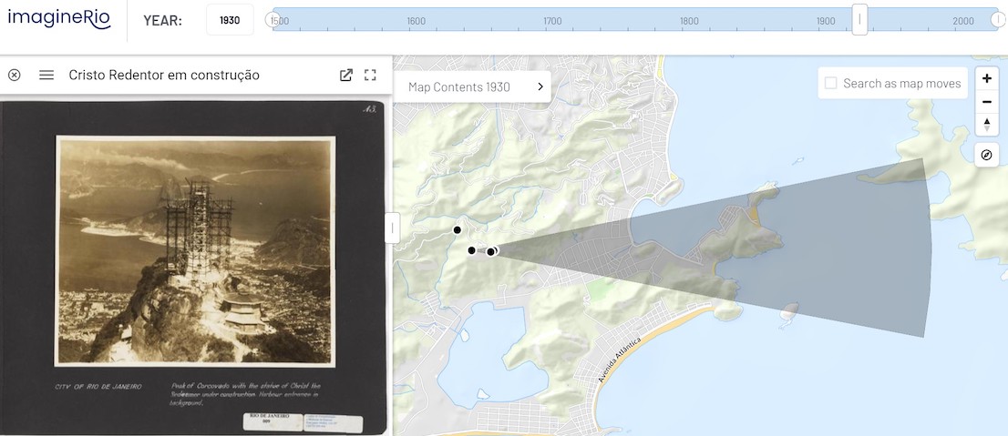 Geolocated aerial view by S. H. Holland showing Christ The Redeemer under construction. Courtesy imagineRio
“We were originally warned against taking on such a long span of Rio’s history, but we somehow pulled it off,” said Farès el-Dahdah, professor of Art History at Rice University. “imagineRio now covers the entire evolution of the city, not only as it once was but also as it has been imagined along the way. This is only possible thanks to the brilliant GIS team at the Spatial Studies Lab and our skilled partners at Axis Maps and IMS.”
The IMS images now added to imagineRio represent the work of dozens of photographers, including two who had profound roles in documenting the evolution of Rio’s built environment. Marc Ferrez (1843-1923) pushed the limits of photographic technology by using large-format and panoramic devices to record views of construction sites, while Augusto Malta (1864-1957) was hired by Rio’s mayor Francisco Pereira Passos as the city’s official photographer to chronicle radical urban change in the early 20th century. Among other historical moments, Malta’s photographs show the demolition of the Morro do Castelo (Castle Hill) historic area as part of the “Bota Abaixo” or “Bring it Down” urban reform campaign. The goal of this campaign was to gentrify the area to rid Rio of its reputation in the early 19th century as an “unhealthy city,” which included sanitizing, renovating, or demolishing buildings such as tenements, rooming houses, and inns.
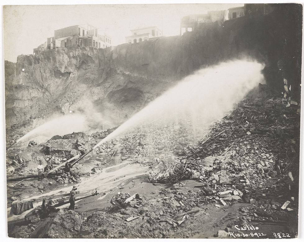 Castelo hill demolition with water jets, view taken from Santa Casa de Misericórdia, August 30, 1922, Augusto Malta. Courtesy Instituto Moreira Salles
“imagineRio allows users to peer over the shoulders of some of Brazil’s most celebrated photographers as they captured a city changing before their eyes,” said Sergio Burgi, head of photography at IMS. “The platform’s new 3D integration transforms these photographs from singular, flat images into a tapestry of interactive moments.”
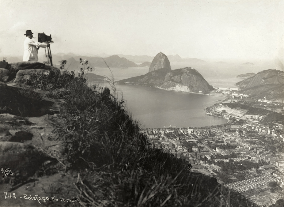
View of Botafogo area and Sugarloaf Mountain taken from Dona Marta lookout, circa 1910, Augusto Malta. Courtesy Instituto Moreira Salles
All of the new photographic additions have been geolocated by technical experts at IMS over a temporally-accurate 3D model of the city. About ten percent of these are processed further through a partnership with Smapshot, a web-based forum that uses crowdsourcing to pinpoint the location of historic photographs in a 3D format with even greater precision.
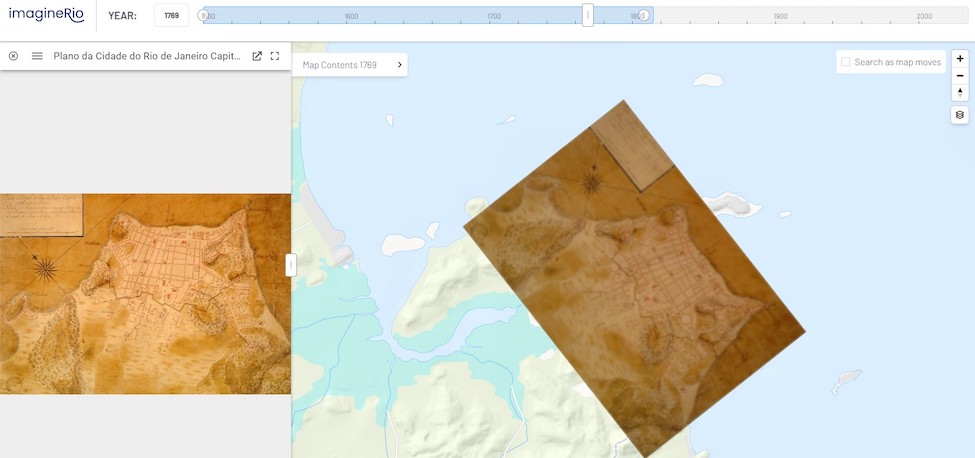 Geolocated map on imagineRio’s interface. Courtesy imagineRio
“Digital mapping propels the past into the present, and there is so much more to come,” said David Heyman, technical lead at Axis Maps who worked with the project team. “We’ve built a solid foundation for imagineRio so that the team can keep experimenting. Engaging more with computer vision, increasing interactivity, going from 3D to 4D–the future is full of possibilities.”
For more information on how to use imagineRio, watch this brief video introduction.
imagineRio was initially developed by professors Farès el-Dahdah and Alida C. Metcalf in collaboration with the Center for Research Computing’s Spatial Studies Lab at Rice University and Axis Maps. The latest platform enhancements made possible by the Getty grant were completed in partnership with Sergio Burgi, Martim Passos, and previously Bruno Buccalon at the Instituto Moreira Salles. In addition to support from the Getty Foundation, the project has also received the financial and technical support of Rice University’s Office of Information Technology, Ken Kennedy Institute, Baker Institute, Fondren Library, the Humanities Research Center, the Department of History, and the Office for Global and Digital Strategy.
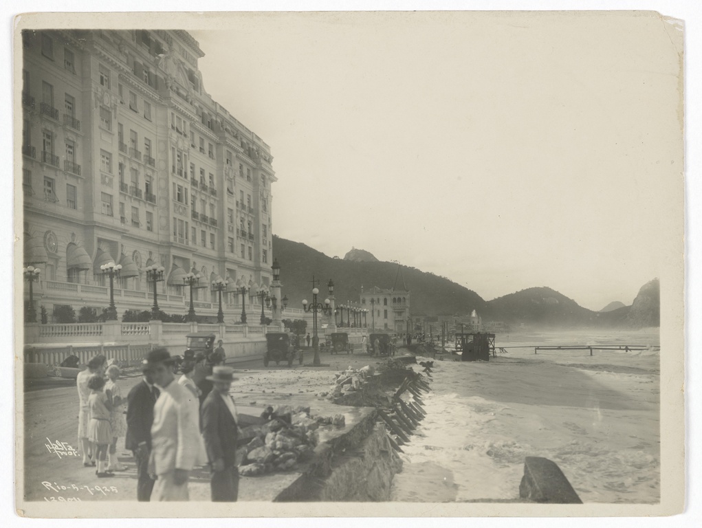 Fachada do Hotel Copacabana Palace. Copacabana Palace Hotel façade. Augusto Malta. 05/07/1925. Courtesy Instituto Moreira Salles
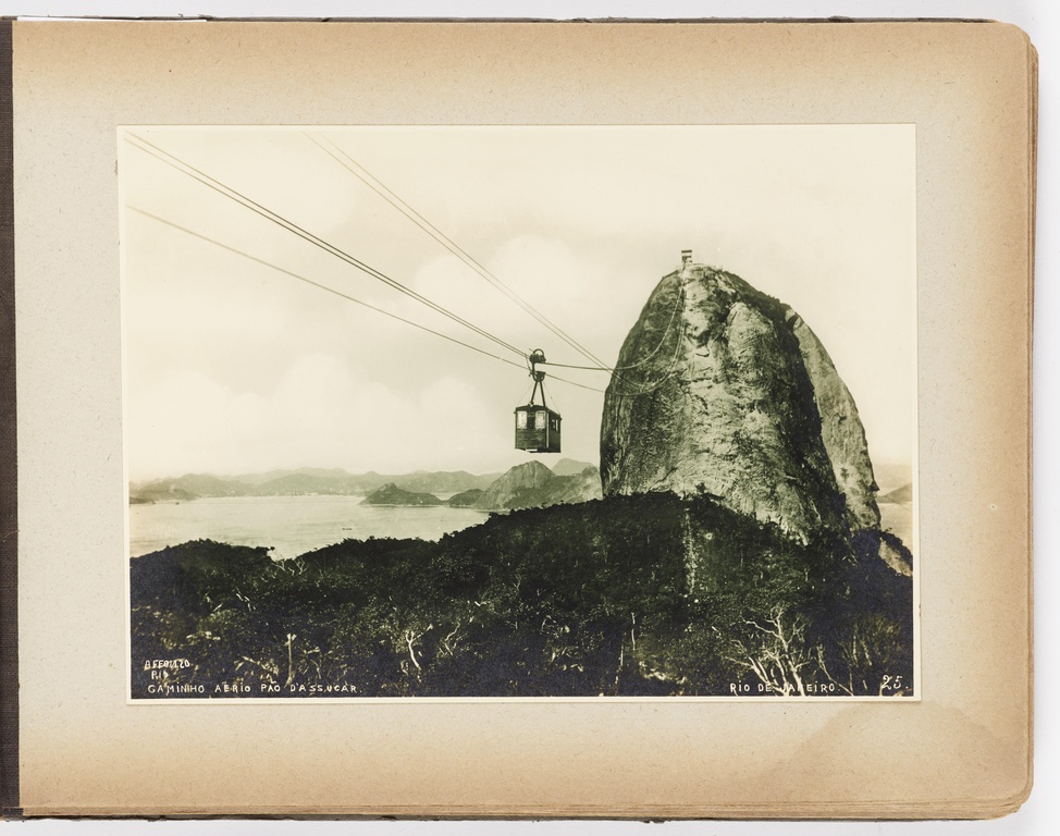 Vista do Pão de Açúcar. View of Sugarloaf Mountain. Photo Lopes Rio. 1920 circa. Courtesy Instituto Moreira Salles
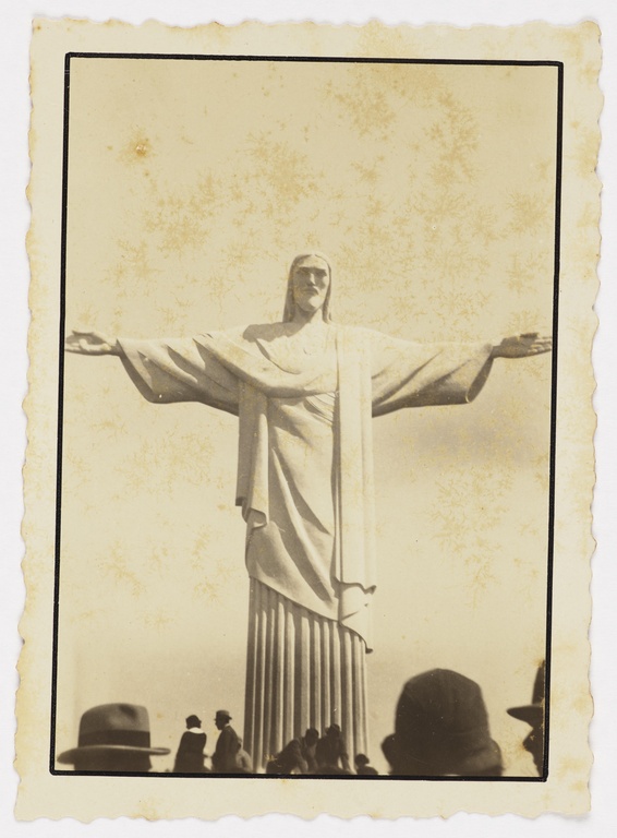
Cristo Redentor. Christ The Redeemer. Alfredo Krausz. Circa 1933. Courtesy Instituto Moreira Salles
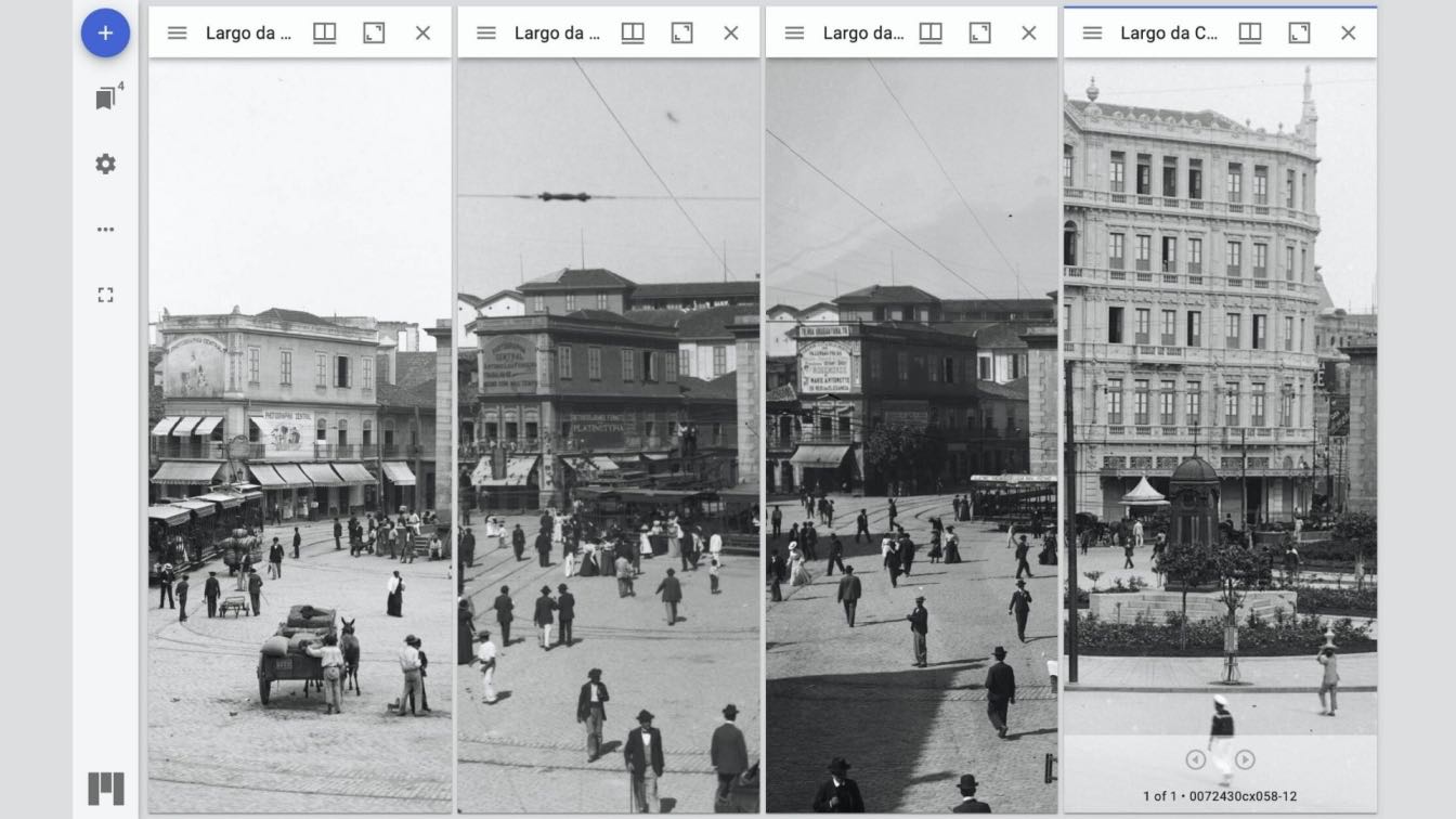
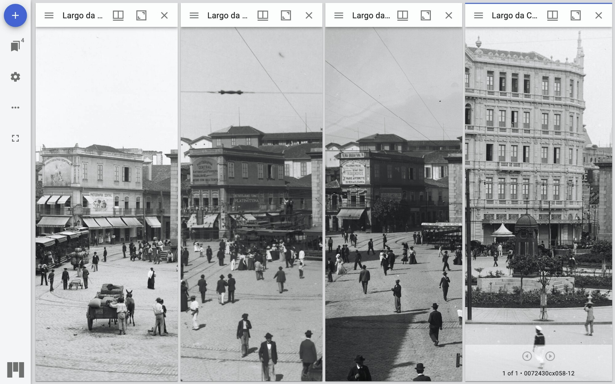 These four glass plate photographs were taken by Marc Ferrez from roughly the same spot in Largo da Carioca (a major plaza in Rio) but at different times, with the oldest image seen at the left. These images show the evolution of a building initially occupied by “Photographia Central,” a photography studio. First the ruins behind it are replaced by new buildings and the facade is modified, then it becomes a clothing store, only to be demolished and give way to Hotel Avenida on the far right. Courtesy imagineRio